Group Rides
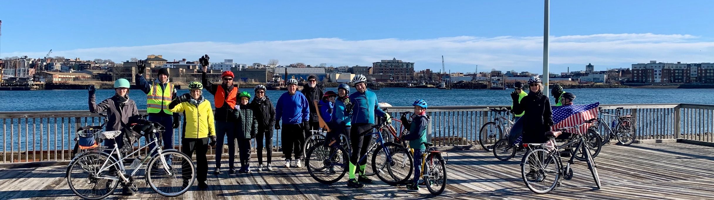
Biking Brookline leads group rides that start and end in Brookline and go to many destinations in the Boston area using routes that are mainly on protected bike paths and low-stress local streets. We ride at a leisurely, relaxed pace and welcome all riders. Our goals are to help people feel more confident about getting around the Boston area by bicycle and to foster a sense of community among people who share a passion for bicycling both as a form of recreation and as a mode of transportation.
Children are welcome rides, but must be accompanied by a parent or guardian if they are 15 or younger.
To join the next upcoming group ride, just complete the ride registration form in the ride description below.
If you missed a ride that you would like to try on your own, you can find links below in the Routes Library to all the routes we have done. Each route description has a link to a map in the navigational app ridewithgps. Biking Brookline’s ridewithgps club subscription allows anyone to use all the navigational features of ridewithgps, including audible cues, when they are riding one of the routes in the Biking Brookline Routes Library, either on a group ride or on their own. In order to gain access to these navigational features, click on this link, then click on “Join Now,” complete the registration form, and install ridewithgps on your smartphone.
Once you are registered with the Biking Brookline ridewithgps club, you can ride any of the Biking Brookline routes by opening ridewithgps on your smartphone and clicking on the link to the map of the route you want to ride, which you can find on the Biking Brookline website under the heading “Routes Library” or on the ridewithgps Biking Brookline routes page. Once you open the map, just click the “Navigate” button to start the ride. You can read more about the Biking Brookline ridewithgps club membership benefits at this link.
Please note that registering with the Biking Brookline ridewithgps club does not automatically make you a Biking Brookline member. We encourage you to also become a Biking Brookline member by clicking Join Us on our home page. This will put you on our email list so you can receive invites to our rides and workshops, and receive email updates about important bicycling developments in Brookline. Biking Brookline membership is free and open to all.
Nova, Age 6, Wrote a Book About her Biking Brookline Ride to Salem!


Upcoming Biking Brookline Group Rides
Biking Brookline does a group ride every few weeks on either a Saturday or Sunday, as weather allows. We notify our members of an upcoming ride by email a few days in advance and also post the rides on our website and our Facebook page.
The rain date for all rides is the Saturday of the same weekend for rides scheduled for a Sunday, and the Sunday of the same weekend for rides scheduled for a Saturday. We will notify all registered riders by email of a change to the rain date by Friday, 5 PM.
Sunday, May 31, 2026, 12-Mile “Highlights of South Brookline” Group Ride
This Sunday, May 31st, Biking Brookline will lead a 12-mile ride on a loop through
South Brookline. We will explore the roads that we hope will be reconfigured to become part of a low-stress bicycle route from South Brookline to Brookline High School. We will be joined by Transportation Board and Precinct 16 Town Meeting member Richard Murphy, who will explain the changes that the Town is considering to create the route.
Along the way, we will visit the graves of Joseph and Rose Kennedy in historic Holyhood Cemetery, and the Lost Pond and D. Blakely Hoar nature sanctuaries, where we will get off our bicycles for short nature walks.
We will take a break at the Municipal Golf Course, where we can get drinks and snacks at the Hemlock Grill, and will then stop for a picnic lunch at Larz Anderson Park. You can bring your own lunch or pick up a sandwich to go at the Hemlock Grill.
When and Where
We will meet in front of the Brookline High School at 9:30 AM and will head out at 9:45 sharp. Please note that this is different from our usual meet-up place and time.
Description of the Ride
The ride will be at a leisurely, relaxed pace, and we will ride as a group. This route has somewhat more riding on main roads than our other routes, but most of it is still on quiet streets, and there is always an option to ride on a sidewalk. We expect the ride, including the two nature walks and breaks, to take 3 - 4 hours.
How to Register for the Ride
If you would like to join us for the ride, please register using this link.
The registration form will ask you to agree to the Release and Waiver of Liability, Assumption of Risk, and Indemnity.
Children are welcome on the ride, but must be accompanied by a parent or guardian if they are 15 or younger. In addition, a parent must complete the registration form for the child and must agree to the Parental Consent Agreement when registering the child (using the same link).
Additional Information
Our leaders are able to help with simple bicycle adjustments and repairs such as flat tires, but if you have not ridden your bicycle for a long time or are not sure if it it roadworthy, it is a good idea to have it checked out by a bike shop before joining the ride. Tube sizes vary considerably, so we also suggest that you bring a spare tube that fits your bike in the unlikely event you do get a flat tire.
We hope you can join us for the ride!

Biking Brookline Routes Library
Below you will find a description of, and link to, each of the routes that we have used on our group rides. All the routes start and end at Kvynet Square in North Brookline unless otherwise stated.

-
This route goes from Brookline High School out to the historic Holyhood Cemetery in Chestnut Hill and then back past the Chestnut Hill Reservoir and on the Commonwealth Avenue carriage road in Brighton and Allston.
-
This route follows local streets in Cambridge and the Charles River path to the Charlestown Navy Yard and Bunker Hill Monument.
-
This route follows the Muddy River, Olmsted Park, and Jamaica Pond paths to the Arnold Arboretum and Franklin Park, returning on local streets in Jamaica Plain and the Jamaica Way Path.
-
This route follows bike paths and local streets through Brookline, Allston, Cambridge, and Belmont to the Alewife Brook Reservation and then back to Brookline via the Somerville Community Path and bike paths and local streets in Somerville and Cambridge.
-
This route follows local streets and protected bike paths in Cambridge and Boston to South Boston and the Seaport District, where it follows the Boston Harbor waterfront and then returns via the North End and the Charles River bike path.
-
The route uses local streets and protected bike paths in Brookline, Boston, Cambridge and Somerville to link the Charles River bike path, the Watertown to Cambridge Greenway, the Fresh Pond Reservation Trail, the Fitchburg Cutoff path, the Alewife Linear path, and the Somerville Community path.
-
This route follows the Emerald Necklace through Brookline, Jamaica Plain, and the Arnold Arboretum, doing a loop on the car-free road in the Arboretum, and then exits the Arboretum at the Forest Hills Gate to follow the Southwest Corridor, local streets, and the Charles River path back to Brookline through the South End, Chinatown, and the North End.
-
This route, which starts and ends at the Brookline High School, goes out to Waltham on local Brookline streets and the Commonwealth Avenue carriage road in Newton and then returns to Brookline along the Charles River Reservation path.
-
This route links the Charles River Paths, the Watertown—Cambridge Greenway, the Fresh Pond Path, the new Concord Avenue sidewalk level and parking protected bike path in Cambridge and Belmont, the Fitchburg Cut-Off path, the Alewife Linear Park, and the newly extended Somerville Community Path, as well as local streets in Brookline, Allston, and Belmont, to create a 24 mile route that is almost entirely on bike trails, protected bike paths, and local streets. It includes a short spur on the Minuteman Bikeway to Spy Pond in Arlington for a beautiful lunch spot.
-
This route follows the Charles River in Cambridge and the Boston Harbor in Charlestown, going past the USS Constitution, and then heading into historic Charlestown past the Bunker Hill Monument. From Charlestown, the route follows paths along the Mystic River through Somerville to Medford, and then heads back via the Alewife Brook Greenway and local streets in Cambridge.
Along the way, you can pick up Italian pastries at the Modern Pastry Shop in Medford and then stop for a picnic lunch at Spy Pond in Arlington.
-
This route goes from North Brookline to the Neponset Greenway, incorporating the Muddy River, Olmsted Park and Jamaica Pond bike paths; car-free roads in the Arnold Arboretum and Franklin Park; local streets in Dorchester, Hyde Park and Roslindale; and the Southwest Corridor bike path.
-
This route goes west along the Charles River to the newly completed Watertown to Cambridge Greenway, and then follows the Alewife Brook and Mystic River reservations, returning to Brookline on protected bike paths and local streets in Somerville and Cambridge.
-
This route goes through Brookline, Cambridge, and Boston to the JFK Library in South Boston, and then back via the Seaport, the North End and the Charles River bike path.
-
This route follows local streets and bike paths to the beginning of the Minuteman Bikeway, then follows the Bikeway to Lexington center, and returns to Brookline on the Somerville Community Path and the Charles River Path in Cambridge.
-
This route connects trails along the Charles, Mystic, and Malden rivers, and Alewife Brook, going through Cambridge, Charlestown, Somerville, Medford, Malden, Everett, and Arlington.
The route includes the southern part of the recenlty completed Northern Strand Trail, which connects Everett, Malden, Revere, Saugus and Lynn, as well as trails in the Alewife Brook Reservation.
This route is similar to the 32-mile route below titled “Charles River and Boston Harbor Paths to Northern Strand in Everett and returning on Somerville Community Path” except that it returns to Brookline on Fitchburg Cut-Off Trail in the Alewife Resevation and the Fresh Pond Trail, while the other route returns on the Somerville Community Path.
-
The route incorporates two Boston Harbor ferry crossings and has three segments:
Knyvet Square in North Brookline to MBTA ferry dock at Long Wharf near the Aquarium (4 miles);
MBTA ferry dock in East Boston to Deer Island via East Boston Greenway, Constitution Beach, and local streets in Winthrop, and then back to MBTA ferry dock (21 miles); and
Please note that there is a separate link to the route for each of the three segments.
The route offers outstanding views of the Boston harbor and skyline from many different vantage points.
The route uses the MBTA ferry to cross the Boston Harbor (the ferry stop in East Boston is called “Logan”). The ferry leaves you off at the beginning of a path that takes you to the beginning of the East Boston Greenway.
This is the same ferry that goes to Hingham and Hull., but not all of them stop at Logan, so be certain to check the ferry schedule before you go. Ferry service is infrequent, but you should be able to get to East Boston in the morning and back to Long Wharf in the afternoon or evening.
The MBTA ferry fare is $9.75 each way, but seniors are half price and children 11 and under are free. If you want to avoid paying the admittedly ridiculously high ferry fare you can ride to Long Wharf and then take the Blue Line from Aquarium to Maverick, which is just a few blocks off the Biking Brookline route.
In August, 2023, there is also a free ferry from Long Wharf to East Boston (it docks in East Boston along the Biking Brookline route), but it is unclear if the service will continue after August 31, 2023, when the Sumner Tunnel work is expected to be completed.
-
This route heads out to the Charlestown Navy Yard through local streets in Cambridge and along the Boston Harbor, then follows the Mystic and Malden river paths to the Northern Strand Trail in Everett, and back to Brookline on the Mystic River, Alewife Brook, and Somerville Community paths.
This route is similar to the 31-mile route above titled “Charles, Mystic and Malden Rivers and Alewife Brook Trails” except that this route returns to Brookline on the Somerville Community Path, while the other route returns on the Fitchburg Cut-Off Trail in the Alewife Reservation and on the Fresh Pond Trail.
-
This route to Salem incorporates the Charles River, Mystic River, Malden River, Northern Strand, Marblehead and Salem bike paths.
You can return to Boston on the Salem ferry and then ride back to North Brookline from Long Wharf using this route that incorporates the Connect Historic Boston and Charles River bike paths. The route to Salem is 26 miles, and the route from Long Wharf to Brookline is 6 miles, making this a 34 mile ride if you return by ferry.
Another return option is to take the MBTA commuter railback from Salem to North Station. This link has the MBTA bicycle policy. There are many bicycle friendly routes back to North Brookline from North Station. This one follows the Charles River path in Cambridge to the Mass Avenue Bridge and the crosses over back to Boston and follows Bay State Road.
-
This route (see links below) follows paths along the Charles, Mystic, and Malden rivers and then the Northern Strand Trail to Nahant. Once it reaches Nahant, the route does a loop on quiet local roads on Nahant with beautiful views of Broad Sound, the ocean, and the Boston skyline. There are many scenic spots on Nahant for a picnic.
You can return to Boston by ferry or train from Lynn. This link shows the Nahant route ending at the Lynn ferry terminal. This link shows the Nahant route ending at the Lynn interim MBTA train station.
If you take the ferry back from Lynn, you can use this 4.6 mile route that follows local streets and protected bike lanes in Boston, or use this 5.9 mile route that follows the Charles River, to return to Brookline from Long Wharf, where the ferry docks. If you take the train back from Lynn, you can use this route to return to Brookline from North Station. If you return on the ferry, the total mileage is 36, including the ride back to Brookline from Long Wharf. If you return by train, the total mileage is 35, including the ride back to Brookline by North Station.
-
This route follows bike paths along the Charles, Mystic, and Malden rivers, and then the new Northern Strand Trail, which connects Everett, Malden, Revere, Saugus and Lynn, and then returns on the Northern Strand and local streets and bike paths in Somerville and Cambridge back to Brookline.
Those who want a shorter ride can ride outbound to Lynn and then return on the MBTA commuter rail back to North Station. The Lynn MBTA station is undergoing renovations, so please be sure to check the MBTA website for the latest details on where to board. From North Station, you can ride back to Brookline on the Charles River path using this route. This option is about 25 miles, including the ride from North Station to Brookline.